Death Valley holds the highest air temperature ever reliably recorded on Earth: 56.7°C, in July 1913. It regularly clears 50°C in summer. It is also, for about five months of the year, one of the most comfortable and least crowded national parks in America.
Which is the whole article, really. Everything here depends on when you go.
Go between November and March. Genuinely.
Winter highs sit around 18 to 24°C, which is close to perfect for walking around a desert. Nights get cold, sometimes near freezing, so bring layers.
March is the sweet spot: warm days, and in a good rainfall year the wildflower bloom happens. In rare years there’s a “superbloom” and the valley floor turns yellow, which is worth rearranging plans for.
April and October are fine, in the high 20s to mid 30s. Manageable with early starts.
May through September is genuinely dangerous. People die here. The park advises against hiking at any elevation below 1,500 metres after 10am in summer, and that isn’t lawyerly caution.
There’s a strange tourism around the heat, incidentally. In July you’ll find people queuing to photograph the thermometer at Furnace Creek visitor centre, which is a fun thing to do for ten minutes in an air-conditioned gap between car journeys. It is not a reason to plan a summer trip. The park looks the same in February and you can actually walk around in it.
The stops that matter
The park is enormous — 13,600 square kilometres, the largest in the lower 48 — but the highlights cluster reasonably well.
- Badwater Basin — the lowest point in North America at 86 metres below sea level, a salt flat you can walk out onto. Look up at the cliff behind the car park for the “sea level” sign.
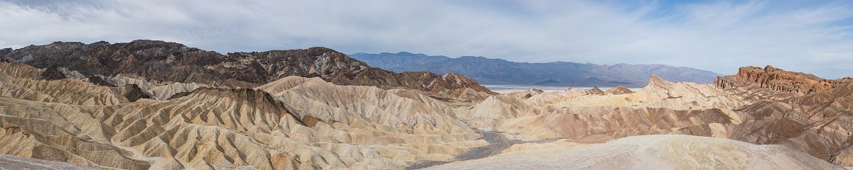
- Zabriskie Point — eroded golden badlands, five minutes from the car. Best at sunrise.
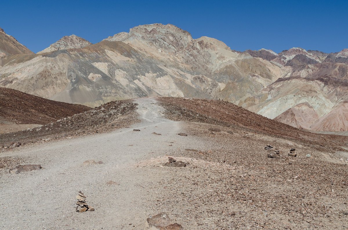
- Artists Drive and Artists Palette — a one-way scenic loop through hills stained green, pink and turquoise by oxidised minerals. Best in late afternoon.
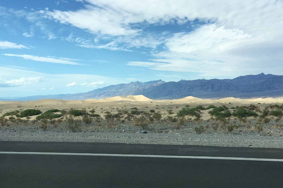
- Mesquite Flat Sand Dunes — classic desert dunes near Stovepipe Wells. Sunrise or sunset for the shadows.
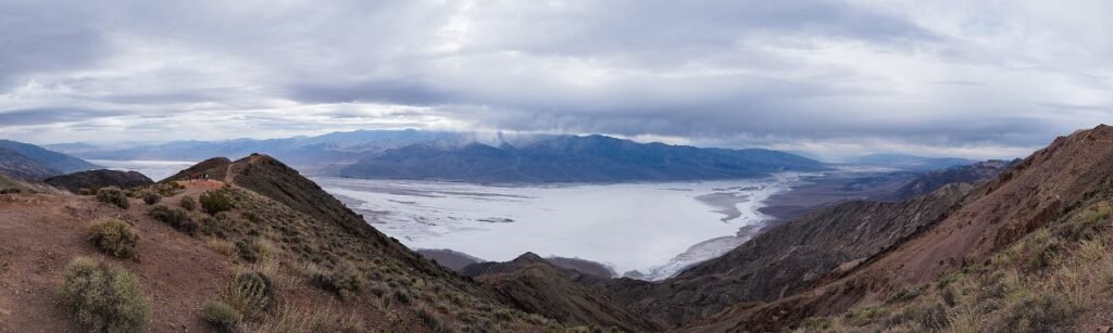
- Dante’s View — 1,669 metres up, looking straight down at Badwater. The single best overview in the park.
- Golden Canyon — a 5km return walk into the badlands. The best short hike here.
A two-day plan that works
Day one: sunrise at Zabriskie Point, Golden Canyon hike while it’s cool, Badwater Basin late morning, Artists Drive in the afternoon, sunset at the Mesquite Dunes.
Day two: sunrise at Dante’s View, then Ubehebe Crater in the north, Mosaic Canyon near Stovepipe Wells, and Darwin Falls if you want to see the one green place in the park.
That’s the park properly done. One day covers the first list only.
Distances are the thing that ruins people’s plans here. Furnace Creek to Ubehebe Crater is about an hour each way, and Dante’s View is another 45 minutes in the opposite direction. Nothing on the map is as close as it looks, and there are no shortcuts because most of the connecting roads are unpaved. Build in more driving time than seems reasonable and you’ll enjoy it far more.
▶ Watch This Before You Go
The Racetrack, and whether it’s worth it
The famous “sailing stones” that leave trails across a dry lakebed. It’s 43km of rough washboard road from the nearest pavement, and the park explicitly recommends high-clearance 4WD with heavy-duty tyres.
Punctures out here are common and a tow is famously expensive — people quote figures in the many hundreds of dollars. There’s no signal.
Honest take: unless you’re properly equipped and comfortable with remote driving, skip it. The stones are a curiosity, not a spectacle, and the rest of the park is more rewarding per hour spent.
The stars are the underrated part
Death Valley is a Gold Tier International Dark Sky Park, which is the highest rating there is. Almost no light pollution for a hundred miles in any direction.
Best spots: Harmony Borax Works, Badwater Basin, the Mesquite Dunes. New moon, obviously. Winter gives you long nights and clear air.
Bring a red torch, let your eyes adapt for 20 minutes, and don’t look at your phone.
Staying and eating
Inside the park: The Oasis at Death Valley (the historic Inn and the more affordable Ranch) at Furnace Creek, plus Stovepipe Wells and Panamint Springs. All limited, all book ahead in winter.
Camping is excellent here in winter. Furnace Creek takes reservations; several others are first-come.
Outside: Beatty, Nevada (about 45 minutes) and Pahrump (about 1 hour) are much cheaper.
Food inside the park is limited and pricey. Bring what you can.
Safety, briefly but seriously
Carry far more water than you think — the park suggests around four litres per person per day, more if you’re active.
Petrol inside the park is very expensive and stations are far apart. Fill up in Beatty, Pahrump or Lone Pine.
There is almost no mobile signal anywhere. Tell someone your plan.
Don’t rely on GPS routing. It has repeatedly sent people down closed or unmaintained roads here, and that’s how rescues start.
If your car breaks down, stay with it. It’s visible; you aren’t.
It’s also worth knowing that the valley floods. It sounds absurd for the driest place in North America, but the ground is baked hard enough that rain runs straight off the mountains and the roads wash out. Storms in 2022 and 2023 closed the park entirely for weeks at a time. If there’s rain in the forecast anywhere near the region, check road status before you commit to the drive in.
FAQ
How long do I need? Two days is right. One long day covers the classics if you start before dawn.
Can I do it from Las Vegas? Yes, it’s about 2 hours to Furnace Creek. A day trip is doable but tight; one overnight is much better.
Do I need a 4×4? No, for everything mentioned here except the Racetrack. The main roads are paved and well maintained.
What’s the entry fee? $30 per vehicle for seven days. There’s often no staffed booth, so pay at a self-service kiosk or online.
Is it worth it in summer if that’s all I have? You can do it, but restrict yourself to viewpoints reachable from the car, go out at dawn and dusk only, and take the warnings literally.
Any wildlife? More than you’d expect — coyotes, roadrunners, bighorn sheep at higher elevations, and pupfish in Salt Creek that have survived here for thousands of years.